
LIOs
16.967 (7)
County Duties
Establish a land information office (LIO). The LIO shall:
- Coordinate land information projects
- Prepare and maintain a plan for land records modernization
- Review and recommend projects (grants) for local governments
A key study by the Wisconsin Department of Administration in 1976 known as the "Larsen Report" identified land records data collection and management as a multi-million dollar activity that begins at the local government level. In an effort to improve the condition and access to this information, and to reduce duplicative efforts, the state established the Wisconsin Land Information Program in 1989.
Today's efforts to modernize Wisconsin land information, improve its quality, and make it broadly accessible are coordinated and facilitated through county Land Information Offices. As part of the Wisconsin Land Information Program, each county has a designated Land Information Office, Land Information Officer, and a Land Information Plan that guides local activities. While each county office may be organized somewhat differently from county to county, all LIOs can be counted on to serve as point of beginning to help find the appropriate county land-related office or service.
Each county has designated a Land Information Officer and is obligated to keep that designation current by notifying the Wisconsin Department of Administration's Division of Intergovernmental Relations.
The LIO Network coordinates the maintenance of its LIO listing with DOA. In addition to the LIO, LION identifies an alternate to the LIO to assist with communication and information sharing. The LIO holds the county vote unless it is designated to the alternate or another designee. The LIO alternate is not a statutorily recognized position.
In order to participate in the Wisconsin Land Information Program, each county must maintain an approved plan for land information modernization that outlines goals, progress and planned and completed activities.
Sam Bortz - GIS Specialist
LIO Information
| LIO Address
PO Box 470 Friendship, WI 53934 (608) 339-4546 |
Brittany Goudos-Weisbecker - GIS Coordinator & LIO Officer
LIO Information
|
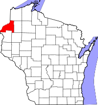
201 Main St West Room 205B Ashland, WI 54806 (715) 685-2002 |
Catlon Phelps - County Surveyor
LIO Information
|
335 E. Monroe Ave Barron, WI 54812 (715) 537-6824 |
Scott Galetka - Land Records Administrator
LIO Information
| LIO Address
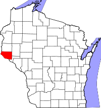
117 E 5th St P.O. Box 878 Washburn, WI 54891 (715) 373-6156 |
LION Alternate
Carmen Novak GIS Coordinator (715) 373-6156 carmen.novak@bayfieldcounty.wi.gov |
www.bayfieldcounty.wi.gov/146/Land-Records scott.galetka@bayfieldcounty.wi.gov
Jeff DuMez - LIO/GIS Coordinator
LIO Information
|
LIO Address
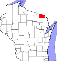
305 East Walnut Street 3rd Floor Green Bay, WI 54301 (920) 448-6295 |
LION Alternate
Chad Miller (920) 448-6295 chadwick.miller@browncountywi.gov |
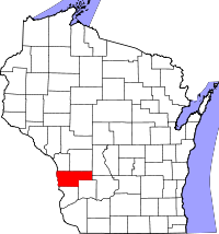
Jacqueline Schneider - GIS Specialist
LIO Information
| LIO Address
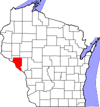
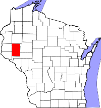
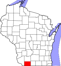
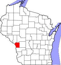
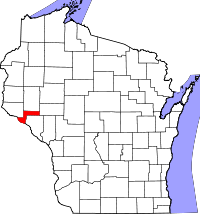
407 S 2nd St P.O. Box 28 Alma, WI 54610 (608) 685-6285 |
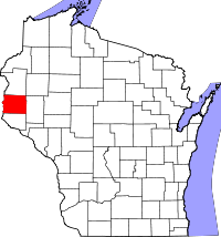
Jason Towne - Land Services Director
LIO Information
|
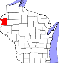
7410 County Rd K #120 Siren, WI 54872 (715) 349-2109 |
Andy Hess - GIS Administrator
LIO Information
|
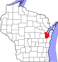
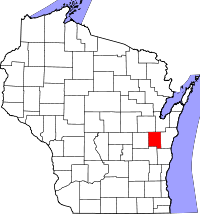
206 Court St Chilton, WI 53014 (920) 849-1442 x2302 |
Douglas Clary - Chippewa County Planning & Zoning Administrator
LIO Information
|
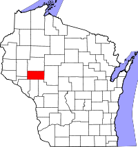
711 N Bridge St Chippewa Falls, WI 54729 (715) 726-7941 |
Derek Weyer
LIO Information
| LIO Address
517 Court St Rm 204 Neillsville, WI 54456 (715) 743-5130 |
LION Alternate
Carrie Morrell - GIS Analyst Planning and Zoning Dept 517 Court St, Rm 204 Neillsville, WI 54456 (715) 743-5299 carrie.morrell@co.clark.wi.us |
John Grams - Land Information Director
LIO Information
|
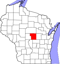
Administration Building 112 East Edgewater Street Portage, WI 53901 (608) 742-9882 |
Gionne (Gigi) Collins - Real Property Lister
LIO Information
|
225 North Beaumont Road Ste 216 Prairie Du Chien, WI 53821 (608) 326-0221 |
Todd Violante - Director, Land Information Officer
LIO Information
| LIO Address
210 Martin Luther King Jr. Blvd Room 110 Madison, WI 53703 (608) 224-3731 |
LION Alternate
Fred Iausly - Senior GIS Analyst 210 Martin Luther King Jr. Blvd Room 339 Madison, WI 53703 (608) 266-4398 iausly.frederic@danecounty.gov |
Nicole Hoeppner - Land Information Officer/Manager
LIO Information
| LIO Address
127 E Oak St Juneau, WI 53039-1329 (920) 386-3772 |
LION Alternate
Jesse ONeill - GIS Administrator Land Resources and Parks 127 E. Oak St Juneau, WI 53039 (920) 386-3706 joneill@co.dodge.wi.us |
Zakry Schwartz - GIS/Land Information Coordinator
LIO Information
|
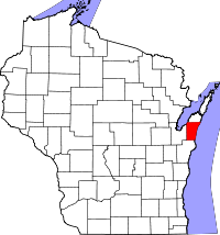
421 Nebraska St Sturgeon Bay, WI 54235-0670 (920) 746-2391 |
Robin Haasis - Interim Land Services Director
LIO Information
|
1313 Belknap St Rm 207A Superior, WI 54880 (715) 395-1291 |
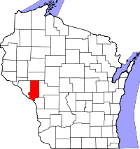
Rachel Wells
LIO Information
| LIO Address
Dunn County Land Information 3001 US Highway 12 East Suite 201 Menomonie, WI 54751 (715) 231-6514 |
Zach Felling
LIO Information
| LIO Address
721 Oxford Ave Rm 3344 Eau Claire, WI 54703-5481 (715) 839-4741 |
LION Alternate
Dean Roth Dean.Roth@co.eau-claire.wi.us |
Donna Liebergen - County Treasurer/Property List/LIO
LIO Information
| LIO Address
501 Lake Ave PO Box 410 Florence , WI 54121 (715) 528-3204 |
LION Alternate
Scott Wolf Zoning Administrator PO Box 410 Florence, WI 54121 (715) 528-3206 swolf@co.florence.wi.us |
Terry Dietzel - LIO
LIO Information
|
160 S Macy St Fond du Lac, WI 54935 (920) 929-3135 |
Kayla Littleton
LIO Information
|
200 E Madison St Crandon, WI 54520 (715) 478-1387 |
Robert Keeney - Land Information Officer
LIO Information
|
111 S. Jefferson St Lancaster, WI 53813 (608) 723-2711 |

Rob Sommers - GIS Specialist / Land Information Officer
LIO Information
| LIO Address
1016 16th Ave Monroe, WI 53566 (608) 328-9635 |
LION Alternate
Jayne Butts Treasurers Office (608) 328-9435 jbutts@greencountywi.org |
Gerald Stanuch - GIS Specialist
LIO Information
| LIO Address
571 County Road A Green Lake, WI 54941 (920) 294-4174 |
LION Alternate
Stefanie Meeker Real Property Lister (920) 294-4015 smeeker@greenlakecountywi.gov |

Scott Godfrey - Director of Planning & Development
LIO Information
| LIO Address
222 N Iowa St Dodgeville, WI 53533 (608) 935-0398 |
LION Alternate
Shaun Wood GIS Coordinator 222 N Iowa St Dodgeville, 53533 (608) 935-0365 shaun.wood@iowacounty.org |
Neil Martinko - Land Information Officer
LIO Information
| LIO Address
Iron County Courthouse 300 Taconite St, Suite 115 Hurley, WI 54534 (715) 561-5803 |
LION Alternate
Bob Traczyk Register of Deeds 300 Taconite St, Suite 115 Hurley, WI, 54534 (715) 561-2945 register@ironcountywi.org |
Cody Brommerich - Land Information Officer
LIO Information
| LIO Address
307 Main St Black River Falls, WI 54615 (715) 284-0221 |
LION Alternate
April Riley (715) 284-0203 April.Riley@Jacksoncountywi.gov |
Tracy Saxby - Land Information Office
LIO Information
|
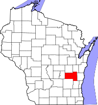
311 S Center Ave, Room 101 Jefferson, WI 53549 (920) 674-7254 |
Liz Housworth - GIS/LIS Specialist
LIO Information
|
220 E State St S/B Room 110 Mauston, WI 53948 (608) 847-9457 |
Scott Schutze - Director | Land Information Office
LIO Information
| LIO Address
1010 56th Street Kenosha, WI 53140 (262) 653-2620 |
LION Alternate
Patricia Pendleton Assistant Director, Division of Land Information (262) 653-2621 patricia.pendleton@kenoshacountywi.gov |
Tammy Malach - Land Information Director
LIO Information
|
810 Lincoln St. Kewaunee, WI 54216 (920) 388-7130 |
Adam Wright - GIS Coordinator
LIO Information
| LIO Address
212 6th Street N - Suite 1300 La Crosse, WI 54601-3200 (608) 785-5921 |
LION Alternate
Kyle Willoughby Senior Real Property Specialist (608) 785-9637 kwilloughby@lacrossecounty.org |
Chris Colney - GIS Coordinator / LIO
LIO Information
| LIO Address
626 Main St Room 203 Darlington, WI 53530 (608) 776-4864 |
LION Alternate
Ashley McDonald Real Property Lister (608) 776-4825 ashley.mcdonald@lafayettecountywi.org |
Christopher Arrowood - Director of Land Records Department
LIO Information
| LIO Address
837 Clermont St Room 129 Antigo, WI 54409 (715) 627-6208 |
Norm Bushor - Land Information Program Manager
LIO Information
| LIO Address
801 N. Sales St Suite 105 Merrill, WI 54452 (715) 539-1049 |
LION Alternate
Nathan Sennett GIS Specialist (715) 539-1087 nathan.sennett@co.lincoln.wi.us |
Tim Ryan - LIO
LIO Information
| LIO Address
1010 S. 8th St. Manitowoc, WI 54221-0421 (920) 683-4186 |
LION Alternate
Cathy DeLain GIS Coordinator 1024 S. 9th St. Manitowoc, WI, 54220 (920) 683-2781 cathydelain@co.manitowoc.wi.us |
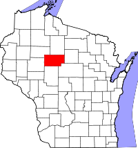
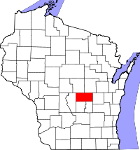
Preston Vande Voort - GIS Coordinator / LIO
LIO Information
| LIO Address
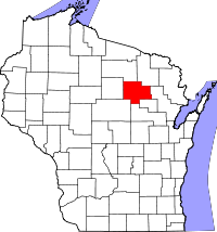
210 River Dr Wausau, WI 54403 (715) 261-6048 |
LION Alternate
Dave Decker County Surveyor 210 River Dr Wausau, WI 54403 (715) 261-6026 dave.decker@co.marathon.wi.us |
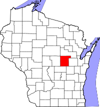
Tim Oestreich - Land Information Director
LIO Information
| LIO Address
1926 Hall Ave Marinette, WI 54143-1717 (715) 732-7541 |
LION Alternate Tina Barnes - Property Lister (715) 732-7548 |
Tom Onofrey - Land Information Officer
LIO Information
| LIO Address
PO Box 21 Montello , WI 53949 (608) 297-3038 |
LION Alternate
Megan Stalker PO Box 21 Montello, WI 53949 (608) 297-3029 mstalker@co.marquette.wi.us |
Ruth Winter - GIS Coordinator/LIO/RPL
LIO Information
|
PO Box 279 Keshena, WI 54135-0279 (715) 799-5845 |
Kevin Bruhn - MCAMLIS Project Manager/LIO
LIO Information
| LIO Address
633 W Wisconsin Ave Suite 903 Milwaukee, WI 53203 (414) 278-3927 |
LION Alternate
John La Fave Register of Deeds 901 N. 9th Street, Courthouse Room 103 Milwaukee, WI 53233 (414) 278-4021 jlafave@milwcnty.com |
Brannick Beatse - Real Property Coordinator
LIO Information
| LIO Address
777 S. Black River St. Suite #2 Sparta, WI 54656 (608) 269-8623 |
LION Alternate
|
David Poffinbarger - LIS Administrator
LIO Information
|
301 Washington St Oconto, WI 54153 (920) 834-6989 |
Sara Chiamulera - Land Information Director
LIO Information
|
1 S Oneida Ave PO Box 400 Rhinelander, WI 54501 (715) 369-6179 |
Brad Bastian - GIS/Land Information Manager
LIO Information
| LIO Address
320 S Walnut St Appleton, WI, 54911 (920) 832-5255 |
LION Alternate
Jonathan.Arndt Jonathan.Arndt@outagamie.org |
Diana Lewis - GIS Coordinator/LIO
LIO Information
|
121 W Main St PO Box 994 Port Washington, WI 53074-0994 (262) 284-8262 |
Maria Nelson, Director, LIO
LIO Information
| LIO Address
740 7th Ave West PO Box 39 Durand , WI 54736 (715) 672-8897 |
LION Alternate
Jessica McMahon County Conservationist (715) 672-7242 jmcmahon@co.pepin.wi.us |
Kevin Etherton - LIO
LIO Information
|
PO Box 647 Ellsworth, WI 54011 (715) 273-6746 |
Brad Runeberg - GIS Coordinator / LIO
LIO Information
| LIO Address
100 Polk County Plaza Ste 130 Balsam Lake, WI 54810-9071 (715) 485-9256 |
LION Alternate
Tracy Klatt Land Information Technician tracy.klatt@polkcountywi.gov |
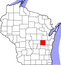
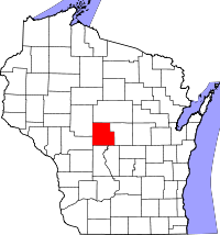
Suman Sirivella - GIS/LIS Coordinator
LIO Information
|
1462 Strongs Ave Stevens Point, WI 54481 (715) 346-1211 |
Evan Lund - Administrator, Zoning and Land Conservation Dept.
LIO Information
|
104 S. Eyder Ave Room 205 Philips , WI 54555 (715) 339-3272 |
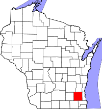
Roland Behm – Director of Public Works & Development Services
LIO Information
| LIO Address
14200 Washington Ave Sturtevant , WI 53177 (262) 886-8470 |
LION Alternate
Kimberly Christman Real Property Lister/GIS Manager 730 Wisconsin Ave Courthouse 1st Floor Racine, WI 53403 (262) 636-3626 Kimberly.Christman@racinecounty.gov |
Julie Lins - Real Property Lister
LIO Information
|
181 West Seminary Street Richland Center, WI 53581 (608) 647-3334 |
Michelle Schultz - Real Property Lister/LIO
LIO Information
| LIO Address
Real Property Description 51 S Main St Janesville, WI 53545 (608) 757-5610 |
LION Alternate
Jennifer Borlick GIS Manager Rock County Planning & Development Agency 51 S. Main St. Janesville, WI, 53545 (608) 757-5592 borlick@co.rock.wi.us |
John Fitzl - GIS Specialist / Division Leader
LIO Information
|
311 Miner Ave East Suite 121 Ladysmith, WI 54848 (715) 532-2165 |
Tatum Fehrenbach - GIS Analyst/LIO
LIO Information
| LIO Address
505 Broadway St West Square Bldg Room 122 Baraboo, WI 53913 (608) 355-3578 |
LION Alternate
Sally Cobb GIS Analyst Sauk County Mapping Dept. 505 Broadway St Baraboo, WI 53913 (608) 355-3562 sally.cobb@saukcountywi.gov |

Brian DeVries - GIS Specialist/LIO
LIO Information
|
Sawyer County Courthouse 10610 Main St Ste 54 Hayward, WI 54843-6569 (715) 638-3261 |
Joe Martell - GIS Analyst/Land Information Officer
LIO Information
|
311 N Main St Shawano, WI 54166 (715) 526-4614 |
Aaron Brault - Planning, Conservation, & Parks Director
LIO Information
| LIO Address
508 New York Ave Sheboygan, WI 53081 (920) 459-3060 |
LION Alternate
Megan Nasgovitz - GIS Specialist (920) 459-1376 megan.nasgovitz@sheboygancounty.com |
Brett Budrow - Land Information Manager, Planning and Zoning Department
LIO Information
|
1101 Carmichael Rd Hudson, WI 54016 (715) 386-4678 |
Justin Meyer - Surveyor/GIS Coordinator
LIO Information
|
224 Second St Medford St, WI 54451 (715) 748-1459 |
Ann Hempel - Land Records Mordernization Coordinator
LIO Information
|
36245 Main St Whitehall, WI 54773 (715) 538-1927 |
Monique Hassman - Land Information Officer
LIO Information
| LIO Address
400 Courhouse Square, Room 205 Viroqua, WI 54665 (608) 637-5314 |
LION Alternate
Tim Dahlen (608) 637-5316 tim.dahlen@vernoncountywi.gov |
Adam Grassl - Land Information Director
LIO Information
| LIO Address
Land Information Deptartment 330 Court St Eagle River, WI 54521 (715) 479-3790 |
Dale Drayna - GIS Supervisor
LIO Information
|
1800 County Road NN Elkhorn, WI 53121 (262) 741-7811 |
Lucas Meier - County Surveyor / Land Information Director
LIO Information
|
10 W. Fourth Ave PO Box 639 Shell Lake , WI 54871 (715) 468-4791 |
Eric Damkot - Data Services Manager/LIO
LIO Information
| LIO Address
432 E. Washington St PO Box 1986 West Bend, WI 53095-7986 (262) 306-2218 |
LION Alternate
Mike Vander Sanden GIS Coordinator (262) 306-2264 |
Kim Meinert - LIO
LIO Information
|
515 W Moreland Blvd. Rm AC170 Waukesha, WI 53188 (262) 548-7816 |
Jason McKeefry - GIS Coordinator/LIO
LIO Information
| LIO Address
811 Harding St Waupaca, WI 54981 (715) 258-6265 |
LION Alternate
|
Stephanie Sattler - Land Records Director
LIO Information
|
380 S Townline Rd Wautoma, WI 54982 (920) 787-6587 |
https://wausharawi.municipalone.com/ Stephanie.sattler@wausharacountywi.gov
Adam Dorn - GIS Administrator
LIO Information
| LIO Address
112 Otter Avenue P.O. Box 2808 Oshkosh, WI 54903-2808 (920) 232-3336 |
Paul Bernard - LIO
LIO Information
| LIO Address
400 Market St Wisconsin Rapids, WI 54495-8095 (715) 421-8466 |
LION Alternate
Jason Grueneberg Planning & Zoning Dir. 400 Market St. Wisconsin Rapids, WI 54495 (715) 421-8478 jgrueneberg@co.wood.wi.us |